National Fire Weather Watches and Warnings
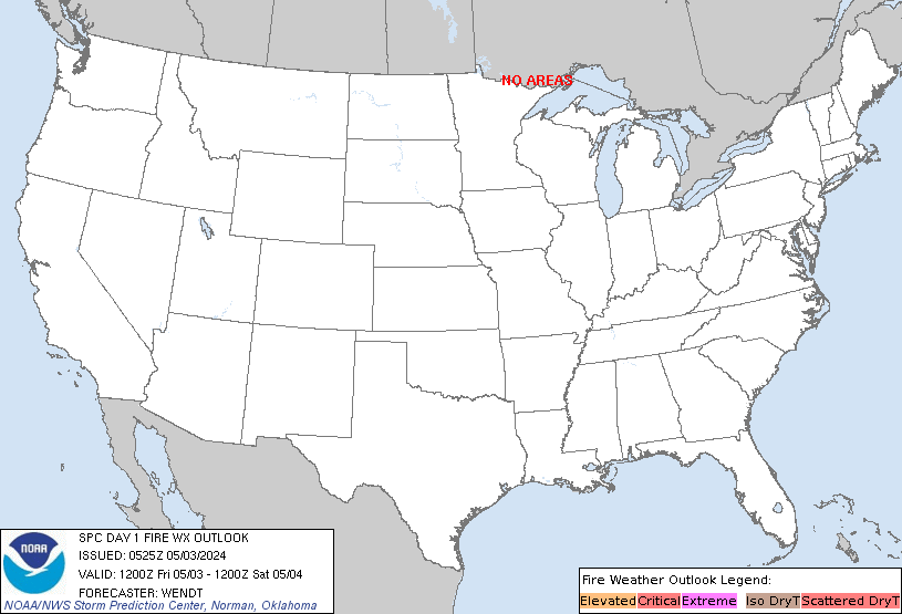


SPC Day 1 Fire Weather Outlook

Current Fire Weather Watches and Warnings for the United States
Issued by the National Weather Service

California

Eastern Portion of Shasta/Trinity NF; Northern Sacramento Valley to Southern Tehama County Line Below 1000 Ft; Central Sacramento Valley including Glenn/Colusa/Yuba/Northern Sutter/Butte County Below 1000 Ft; Southeast Edge Shasta/Trinity NF and Western Portions of Tehama/Glenn RU; Eastern Mendocino NF
Michigan

Keweenaw; Ontonagon; Houghton; Baraga; Marquette; Gogebic; Iron; Dickinson; Menominee; Southern Houghton
Wildfire Reports/Updates


InciWeb Incident Publication Feed

Inciweb Fire Incidents

  • Jun 1 2025 at 8:43 am EDT
    Last updated: 2025-06-02 --- The type of incident is Wildfire and involves the following unit(s) Montana Department of Natural Resources & Conservation. --- State: Montana --- Coordinates: Latitude: 47° 30 52.6 Longitude: 11...

  • May 27 2025 at 11:34 am EDT
    Last updated: 2025-06-02 --- The type of incident is Wildfire and involves the following unit(s) Gila National Forest. --- State: New Mexico --- Coordinates: Latitude: 34° 08 46.7 Longitude: 108° 28 43.4 --- NOTE: All fi...

  • May 27 2025 at 11:27 am EDT
    Last updated: 2025-05-28 --- The type of incident is Wildfire and involves the following unit(s) Coronado National Forest. --- State: Arizona --- Coordinates: Latitude: 32° 38 31 Longitude: 109° 48 29 --- NOTE: All fire ...

  • May 23 2025 at 12:15 pm EDT
    Last updated: 2025-05-30 --- The type of incident is Wildfire and involves the following unit(s) Inyo National Forest. --- State: California --- Coordinates: Latitude: 38° 0 23.724 Longitude: 119° 9 15.948 --- NOTE: All ...

  • May 23 2025 at 10:26 am EDT
    Last updated: 2025-06-02 --- The type of incident is Wildfire and involves the following unit(s) Superior National Forest. --- State: Minnesota --- Coordinates: Latitude: 48° 05 33.6 Longitude: 91° 42 28.8 --- NOTE: All ...

  • May 21 2025 at 9:00 am EDT
    Last updated: 2025-06-01 --- The type of incident is Wildfire and involves the following unit(s) Coronado National Forest. --- State: Arizona --- Coordinates: Latitude: 32° 35 7.8 Longitude: 110° 44 19.1754 --- NOTE: All...

  • May 20 2025 at 10:59 am EDT
    Last updated: 2025-05-21 --- The type of incident is Wildfire and involves the following unit(s) Coronado National Forest. --- State: Arizona --- Coordinates: Latitude: 32° 35 41.7 Longitude: 110° 46 1.08 --- NOTE: All f...

  • May 20 2025 at 4:02 am EDT
    Last updated: --- The type of incident is Prescribed Fire and involves the following unit(s) Hiawatha National Forest. --- State: Michigan --- Coordinates: Latitude: 45° 52 39.9 Longitude: 84° 49 50.4 --- NOTE: All fire ...

  • May 20 2025 at 3:46 am EDT
    Last updated: --- The type of incident is Prescribed Fire and involves the following unit(s) Hiawatha National Forest. --- State: Michigan --- Coordinates: Latitude: 45° 56 15.7 Longitude: 86° 57 49.7 --- NOTE: All fire ...

  • May 20 2025 at 3:16 am EDT
    Last updated: --- The type of incident is Prescribed Fire and involves the following unit(s) Ottawa National Forest. --- State: Michigan --- Coordinates: Latitude: 46° 15 43.8 Longitude: 89° 10 30.4 --- NOTE: All fire pe...

  • May 19 2025 at 3:11 am EDT
    Last updated: 2025-05-23 --- The type of incident is Wildfire and involves the following unit(s) Sequoia National Forest. --- State: California --- Coordinates: Latitude: 35° 28 49.7994 Longitude: 118° 42 38.52 --- NOTE:...

  • May 14 2025 at 2:12 am EDT
    Last updated: --- The type of incident is Prescribed Fire and involves the following unit(s) Grand Teton National Park. --- State: Wyoming --- Coordinates: Latitude: 43° 39 54.955 Longitude: 110° 39 51.964 --- NOTE: All ...

  • May 13 2025 at 11:02 am EDT
    Last updated: 2025-05-26 --- The type of incident is Wildfire and involves the following unit(s) Arizona Department of Forestry and Fire Management - Northeast District. --- State: Arizona --- Coordinates: Latitude: 34° 01 20...

  • May 13 2025 at 6:07 am EDT
    Last updated: 2025-05-20 --- The type of incident is Wildfire and involves the following unit(s) Minnesota Department of Natural Resources. --- State: Minnesota --- Coordinates: Latitude: 47° 04 49 Longitude: 92° 20 38 ---...

  • May 12 2025 at 10:51 am EDT
    Last updated: 2025-06-02 --- The type of incident is Wildfire and involves the following unit(s) Superior National Forest. --- State: Minnesota --- Coordinates: Latitude: 47° 22 33 Longitude: 91° 58 64 --- NOTE: All fire...

  • May 11 2025 at 10:35 am EDT
    Last updated: 2025-05-28 --- The type of incident is Wildfire and involves the following unit(s) Minnesota Department of Natural Resources. --- State: Minnesota --- Coordinates: Latitude: 47° 17 24 Longitude: 91° 50 28 ---...

  • May 9 2025 at 9:57 am EDT
    Last updated: 2025-05-13 --- The type of incident is Wildfire and involves the following unit(s) Arizona Department of Forestry and Fire Management - Southeast District. --- State: Arizona --- Coordinates: Latitude: 32° 56 30...

  • May 8 2025 at 12:39 pm EDT
    Last updated: 2025-05-08 --- The type of incident is Prescribed Fire and involves the following unit(s) Wallowa-Whitman National Forest. --- State: Oregon --- Coordinates: Latitude: 44° 43 40 Longitude: 118° 0 40 --- NOT...

  • May 8 2025 at 11:45 am EDT
    Last updated: 2025-05-13 --- The type of incident is Wildfire and involves the following unit(s) Bitterroot National Forest. --- State: Montana --- Coordinates: Latitude: 46° 29 24.65 Longitude: 114° 17 19.87 --- NOTE: A...

  • May 8 2025 at 10:57 am EDT
    Last updated: 2025-05-08 --- The type of incident is Prescribed Fire and involves the following unit(s) Wallowa-Whitman National Forest. --- State: Oregon --- Coordinates: Latitude: 45° 39 32.40 Longitude: 117° 12 36.00 --...

  • May 6 2025 at 6:37 am EDT
    Last updated: 2025-05-23 --- The type of incident is Prescribed Fire and involves the following unit(s) Klamath National Forest. --- State: California --- Coordinates: Latitude: 41° 45 09.8 Longitude: 122° 47 44.8 --- NO...

  • May 5 2025 at 4:59 am EDT
    Last updated: --- The type of incident is Wildfire and involves the following unit(s) Nez Perce - Clearwater National Forests. --- State: Idaho --- Coordinates: Latitude: 45° 22 50.3 Longitude: 116° 26 24 --- NOTE: All f...

  • May 3 2025 at 1:14 am EDT
    Last updated: 2025-05-15 --- The type of incident is Wildfire and involves the following unit(s) Beaverhead-Deerlodge National Forest. --- State: Montana --- Coordinates: Latitude: 45° 49 41 Longitude: 113° 15 10 --- NOT...

  • May 1 2025 at 11:43 am EDT
    Last updated: 2025-05-01 --- The type of incident is Prescribed Fire and involves the following unit(s) Wallowa-Whitman National Forest. --- State: Oregon --- Coordinates: Latitude: 44° 64 98 Longitude: 118° 06 32 --- NO...

  • May 1 2025 at 10:32 am EDT
    Last updated: 2025-05-08 --- The type of incident is Prescribed Fire and involves the following unit(s) Wallowa-Whitman National Forest. --- State: Oregon --- Coordinates: Latitude: 45° 43 26.4 Longitude: 117° 14 42 --- ...

  • Apr 30 2025 at 7:39 am EDT
    Last updated: 2025-05-29 --- The type of incident is Wildfire and involves the following unit(s) National Forests in North Carolina. --- State: North Carolina --- Coordinates: Latitude: 34° 51 45 Longitude: 77° 6 51 --...

  • Apr 28 2025 at 6:37 am EDT
    Last updated: 2025-05-03 --- The type of incident is Wildfire and involves the following unit(s) Arizona Department of Forestry and Fire Management - Southeast District. --- State: Arizona --- Coordinates: Latitude: 31° 56 42...

  • Apr 24 2025 at 11:25 am EDT

  • Apr 24 2025 at 11:08 am EDT

  • Apr 24 2025 at 10:41 am EDT

  • Apr 23 2025 at 6:58 am EDT

  • Apr 23 2025 at 6:41 am EDT

  • Apr 13 2025 at 12:41 pm EDT
    Last updated: --- The type of incident is Wildfire and involves the following unit(s) Pike & San Isabel N.F.. --- State: Colorado --- Coordinates: Latitude: 38° 59 38.4 Longitude: 105° 01 24.5 --- NOTE: All fire perimete...

  • Apr 12 2025 at 9:27 am EDT
    Last updated: --- The type of incident is Wildfire and involves the following unit(s) Cheyenne River Agency. --- State: South Dakota --- Coordinates: Latitude: 45° 05 38 Longitude: 100° 24 17 --- NOTE: All fire perimeter...

  • Apr 8 2025 at 4:30 am EDT
    Last updated: 2025-04-11 --- The type of incident is Prescribed Fire and involves the following unit(s) Bridger-Teton National Forest. --- State: Wyoming --- Coordinates: Latitude: 43° 22 27 Longitude: 110° 45 34 --- NOT...

  • Mar 25 2025 at 11:08 am EDT
    Last updated: 2025-04-11 --- The type of incident is Prescribed Fire and involves the following unit(s) Bridger-Teton National Forest. --- State: Wyoming --- Coordinates: Latitude: 42° 44 612 Longitude: 110° 55 57.18 --- ...

  • Mar 25 2025 at 2:22 am EDT
    Last updated: 2025-05-09 --- The type of incident is Prescribed Fire and involves the following unit(s) Chippewa National Forest. --- State: Minnesota --- Coordinates: Latitude: 47° 04 5 Longitude: 94° 15 9 --- NOTE: All...

  • Mar 15 2025 at 11:33 am EDT
    Last updated: --- The type of incident is Wildfire and involves the following unit(s) Standing Rock Agency. --- State: North Dakota --- Coordinates: Latitude: 45° 38 00.7 Longitude: 100° 37 37 --- NOTE: All fire perimete...

  • Mar 10 2025 at 9:53 am EDT
    Last updated: 2025-03-16 --- The type of incident is Wildfire and involves the following unit(s) Cheyenne River Agency. --- State: South Dakota --- Coordinates: Latitude: 44° 39 15 Longitude: 101° 59 02 --- NOTE: All fir...

  • Feb 5 2025 at 4:05 am EST
    Last updated: --- The type of incident is Prescribed Fire and involves the following unit(s) Texas A&M Forest Service. --- State: Texas --- Coordinates: Latitude: 32° 50 22 Longitude: 98° 2 25 --- NOTE: All fire perimete...

  • Nov 23 2024 at 1:50 am EST
    Last updated: 2024-11-28 --- The type of incident is Wildfire and involves the following unit(s) Inyo National Forest. --- State: California --- Coordinates: Latitude: 36° 30 18.1074 Longitude: 118 ° 6 8.784 --- NOTE: Al...

  • Nov 12 2024 at 1:29 am EST
    Last updated: 2025-04-30 --- The type of incident is Prescribed Fire and involves the following unit(s) Mendocino National Forest. --- State: California --- Coordinates: Latitude: 39° 31 48.7554 Longitude: 122° 12 44.676 -...

  • Oct 29 2024 at 5:13 am EDT
    Last updated: 2025-04-16 --- The type of incident is Prescribed Fire and involves the following unit(s) Rocky Mountain National Park. --- State: Colorado --- Coordinates: Latitude: 40° 22 2.33 Longitude: 105° 34 4.54 --- ...

  • Sep 17 2024 at 10:49 am EDT
    Last updated: 2025-05-08 --- The type of incident is Prescribed Fire and involves the following unit(s) Allegheny National Forest. --- State: Pennsylvania --- Coordinates: Latitude: 41° 37 03.2 Longitude: 79° 16 33.6 --- ...

  • Apr 19 2024 at 1:26 am EDT
    Last updated: --- The type of incident is Prescribed Fire and involves the following unit(s) Nez Perce - Clearwater National Forests. --- State: Idaho --- Coordinates: Latitude: 45° 23 27.55 Longitude: 116° 25 7.43 --- N...

  • Apr 17 2024 at 6:30 am EDT
    Last updated: 2025-04-07 --- The type of incident is Prescribed Fire and involves the following unit(s) Coconino National Forest. --- State: Arizona --- Coordinates: Latitude: 35° 11 8.9 Longitude: 111° 40 26 --- NOTE: A...

  • Mar 16 2023 at 10:02 am EDT
    Last updated: 2025-05-18 --- The type of incident is Prescribed Fire and involves the following unit(s) Arapaho and Roosevelt National Forests and Pawnee National Grassland. --- State: Colorado --- Coordinates: Latitude: 39° ...

  • Jan 18 2023 at 3:50 am EST
    Last updated: 2025-04-30 --- The type of incident is Prescribed Fire and involves the following unit(s) Mendocino National Forest. --- State: California --- Coordinates: Latitude: 39° 31 48.7554 Longitude: 122° 12 44.676 -...

  • Nov 8 2022 at 12:02 pm EST
    Last updated: 2025-04-25 --- The type of incident is Prescribed Fire and involves the following unit(s) Arapaho and Roosevelt National Forests and Pawnee National Grassland. --- State: Colorado --- Coordinates: Latitude: 40° ...

  • Nov 2 2022 at 3:33 am EDT
    Last updated: 2025-05-27 --- The type of incident is Prescribed Fire and involves the following unit(s) San Juan National Forest. --- State: Colorado --- Coordinates: Latitude: 37° 16 24.2796 Longitude: 107° 53 34.8822 ---...