Union City, CA Weather
61°F
UCWEATHER.ORG
[Enable JavaScript for live updates]
Updated
:
Sat, 04-Oct-2025 10:20pm EDT
clear
Temperature:
61.2°F
/hr
Humidity:
82
%
Dew Point:
55.7
Wind:
W
0.0 mph
Gust:
0.0 mph
Pressure:
29.831 inHg
Steady
Rain Today:
0.00 in
UV-index:
0.0
None
This page is updated automatically every 3 minutes.
Updated: Oct 05, 2025 01:21:07 am EDT
SPC Tornado/Severe Thunderstorm Watches
SPC - No watches are valid as of Sat Sep 27 02:02:02 UTC 2025
SPC Mesoscale Discussions
SPC - No MDs are in effect as of Sat Oct 4 23:01:02 UTC 2025
SPC Convective Outlooks
SPC Oct 5, 2025 0100 UTC Day 1 Convective Outlook
NWS Enhanced Radar Images
Intellicast National Radar
Blitzortung.org - Live Lightning Maps
Real-Time Lightning Map
SPC Storm Reports
NWSChat Local Storm Reports
California Storm Reports
East Coast Storm Reports
Gulf Coast Storm Reports
Email and SMS Weather Alert Services
WXWarn
IEMBOT Web Based Monitor
The Tornado Project Online
Websites Dedicated to Specific Tornado Events
The Online Tornado FAQ
Storm Prediction Center Monthly Tornado Statistics
SPC Annual U.S. Killer Tornado Statistics
Tornado Videos
SevereStudios.com
Gulf Coast Weather Forums
NCDC Storm Events Database
NOAA Weather Radio
Skywarn
Index To Skywarn Web Pages
Spotter Network
mPING
StormReady
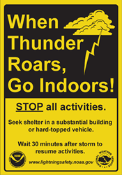
National Weather Service Safety Tips
NWS Awareness and Preparedness Calendar
Current Tornado/Severe Thunderstorm/Flash Flood Warnings for the
United States Issued by the National Weather Service